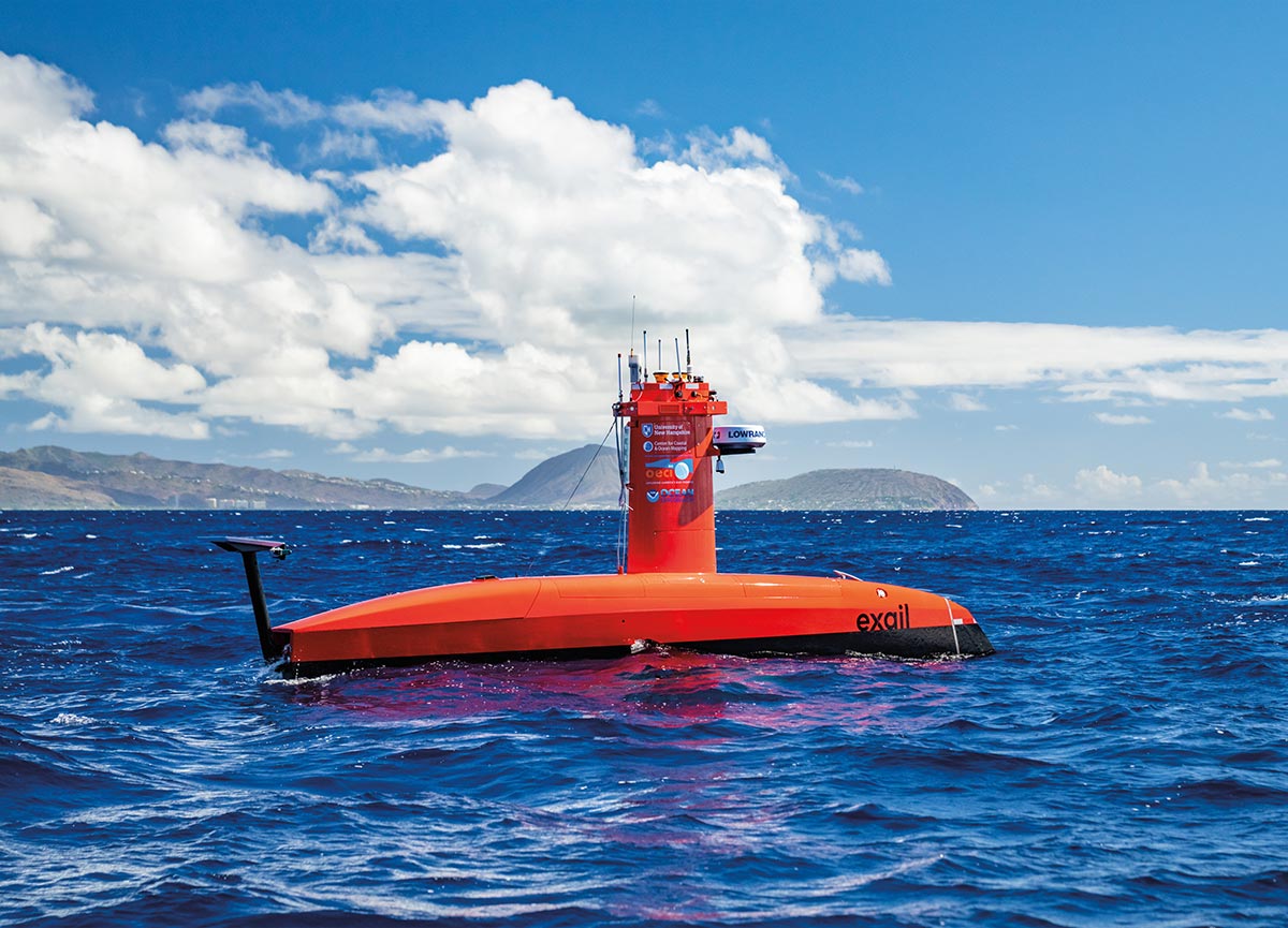
UNH’s autonomous surface vehicle, BEN.
What Lies Beneath

Story By Beth Potier
For decades, we’ve looked on in wonder as scientists have explored outer space — landing on the Moon and walking through its chalky surface, wondering if signs of water could signal life on Mars, proving or disproving theories on black holes and solar flares, redefining planets and returning awe-inspiring images of our solar system.
But when it came to our own planet, more than half of it remained largely unknown and unstudied.
Now, UNH is on the forefront of one of the greatest exploration efforts of modern times — mapping the uncharted, unidentified and often mysterious ocean deep.
But why not leave it a natural unknown? Why not let our imaginations run wild with images of strange seabed creatures, swimming furtively through the dark waters? Or allow us to dream of sunken, hidden treasures from centuries-old shipwrecks, resting and rusting calmly on a murky ocean floor for eternity?
Because what lies beneath us has everything to do with what’s going on around us, every day.
UNH’s autonomous surface vehicle, BEN.


Mayer has been at this work for more than 40 years, the past 25 at UNH’s CCOM. He and colleagues point out the many reasons we need to better understand the global seafloor. First among them is safe navigation, but there’s also the search for resources and infrastructure like cables and pipelines. Modeling deadly storm surge and tsunamis. Understanding (and protecting) corals, sponges and other ecosystems. There are even implications that let nations claim more undersea resources beyond the existing offshore exclusive economic zone.
The seafloor is at the root of understanding a changing climate as well, says Mayer. “The climate system is driven by the distribution of heat on the planet, and heat is mostly distributed by ocean currents on the planet, and where the deep currents go is controlled by the ocean bathymetry”— or measurement of depth in a body of water — the same way we use topography to describe land.
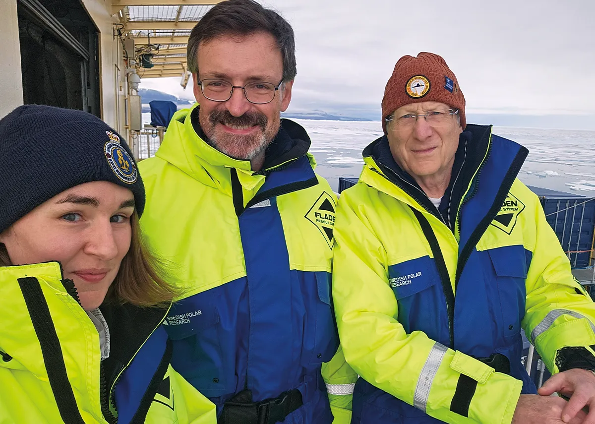
Ph.D. graduate Elizabeth Weidner, CCOM Associate Director Brian Calder and CCOM Director Larry Mayer aboard the Oden vessel.
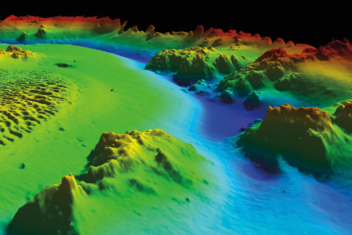
An image from an ocean mapping expedition.
Ph.D. graduate Elizabeth Weidner, CCOM Associate Director Brian Calder and CCOM Director Larry Mayer aboard the Oden vessel.
An image from an ocean mapping expedition.
Expanding the country, growing the industry
The U.S. gained that seabed territory through a complex geopolitical process called the Extended Continental Shelf, which extends nations’ territories beyond 200 nautical miles from their coasts if they can meet certain geophysical conditions. To satisfy those requirements and collect necessary data about the depth and shape of the seafloor, the federal government turned to a team of the nation’s top ocean mappers: those at UNH.
“The mapping done by UNH led to the increase in the size of the U.S.,” says Mayer. It’s a bold claim, but Mayer has every reason to boast. The Center for Coastal and Ocean Mapping and its sister NOAA partnership, the Joint Hydrographic Center, are the world leaders in both how we map the deep and who conducts that exploration.
In CCOM’s quarter century, it’s developed the fundamental technology that helps us map the seafloor and understand what the data tells us. The 238 graduates of its master’s, Ph.D. and certificate programs lead hydrographic agencies and ocean mapping efforts across the globe; three of the last four admirals who directed NOAA’s Office of Coast Survey are UNH and CCOM alumni. Its researchers and students are aboard seafloor mapping missions around the world, from Arctic Greenland to the South Pacific. And the center’s researchers and technological innovations played starring roles in issues that made headlines in recent years: the Deepwater Horizon oil spill, the search for the downed Malaysian Air Flight MH370 and the rapid melting of the Greenland ice sheet.
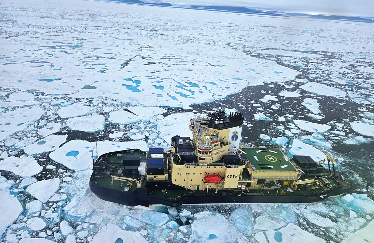
The Swedish icebreaker Oden at work.
Sounding the sea
Like the fishfinders used by anglers, echosounders transmit acoustic waves through the water, where sound travels more than four times faster than through the air. The interval of time between when a pulse of sound is emitted and when it returns, or echoes, measures the distance between the source — generally mounted on the bottom of a ship or other vessel — and the target.
That means ocean mappers, like so many others, do their work in front of a computer, very likely using technology developed at CCOM to help them understand and visualize the data pinging back from the deep.
While they may not go in the ocean, ocean mappers spend a significant amount of time on it, collecting data on board ships that methodically traverse the area to be mapped in a gridded pattern. Each year, CCOM researchers participate in dozens of research expeditions, spanning the globe from the tropical Pacific Ocean to the harsh, unexplored Arctic to the nearby Gulf of Maine on board the CCOM research vessel Gulf Surveyor, purpose-built for ocean mapping.
The discomforts of working at sea — harsh weather, rough seas, weeks or months away from home — pale in comparison to the thrill of exploration. Just ask recent Ph.D. graduate Elizabeth Weidner, who mapped aboard the Swedish icebreaker Oden for two months this past summer with Mayer and CCOM Associate Director Brian Calder. “On more than one occasion, Brian … turned to me and said with genuine amazement, ‘We get paid to do this.’”
Mayer, who estimates he’s spent nearly seven years at sea throughout his career, still finds wonder in exploring the ocean. “We encountered some of the most remarkable scenery and lighting I have ever seen,” he noted during a Greenland cruise.
Next-gen hydrography and hydrographers
CCOM has stayed a steady course in serving its founding goals: to be a world leader in the development of ocean mapping technologies and to educate a new generation of hydrographers.
But at the end of the last century, multibeam echosounding, which sends a fan-shaped swath of sound to the seafloor to greatly increase the efficiency of mapping, emerged. Mayer and colleagues were pioneering the adoption of this new technology, collaborating with NOAA and the U.S. Navy — from the University of New Brunswick in Canada.
“It was recognized that such an entity would be useful in the States, rather than sending money to Canada,” says Mayer. NOAA turned to UNH for a partnership that launched the Joint Hydrographic Center. Co-directed from the start by Mayer with Andy Armstrong, then a NOAA officer, that center exists in parallel with CCOM at UNH, serving NOAA’s needs to create navigational charts.
Marine Slingue, Exail president, calls CCOM “a fearless innovator, working out the nitty gritty of new functionalities. CCOM provides us with invaluable feedback on operations, and this close collaboration enables us to continuously enhance DriX.”
Know Your
Ocean Vocabulary
Hydrography: collecting physical data about the seafloor and coast to create charts for safe navigation.
Ocean mapping: a broader enterprise, encompassing mapping to understand the dynamics of the seafloor, the composition of the seafloor and even what’s happening in the water column.
Water column: a vertical section of sea extending from the surface to the ocean floor.
Bathymetry: measurement of depth in bodies of water, the same way we talk about topography for land.
Echosounding: technique that determines the depth of a body of water by transmitting sound waves through the water and measuring the interval of time it takes the “echo” to come back to the source.

Know Your Ocean Vocabulary
Hydrography: collecting physical data about the seafloor and coast to create charts for safe navigation.
Ocean mapping: a broader enterprise, encompassing mapping to understand the dynamics of the seafloor, the composition of the seafloor and even what’s happening in the water column.
Water column: a vertical section of sea extending from the surface to the ocean floor.
Bathymetry: measurement of depth in bodies of water, the same way we talk about topography for land.
Echosounding: technique that determines the depth of a body of water by transmitting sound waves through the water and measuring the interval of time it takes the “echo” to come back to the source.
Much more than maps
“So much is unknown about the Victoria Fjord, including how deep it is, how deep the glaciers are on either side and the depth of the underwater ridges at the entrance of the fjord,” says Mayer. These characteristics inform how fjords — long, deep inlets — control how fast the glaciers melt and contribute to global sea level rise.
“It’s an example of how technology developed for one purpose, if you’re flexible enough, can be turned to another,” Mayer has said.
He calls that effort in the Gulf of Mexico the most personally satisfying work he’s done throughout his UNH career. “I go up to the Arctic and I know we’re working on super, super important climate problems, and I know that every day here we do things that improve safety and navigation. But with Deepwater Horizon, on a day-to-day basis, we really knew that we were serving the country.”
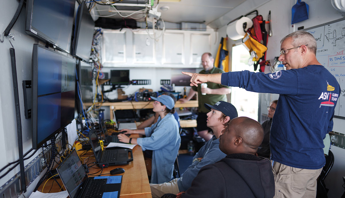
Partnering with industry — and robots
Val Schmidt, principal research project manager for CCOM, oversees autonomous surface vessel (ASV) operations. Continually evolving their independence from human operators aboard ships or nearby on shore, these uncrewed mapping vessels, working like oceangoing Roombas, increase efficiency while decreasing costs. And robots are ideal for a task whose back-and-forth surveying is so repetitive, oceanographers describe it as “mowing the lawn.”
“What a perfect mission for a robotic vessel,” Schmidt says.
The partnership is a win-win: CCOM gains access to cutting-edge technology, and Exail maintains close connections to the powerful research and development talents of UNH’s scientists and engineers whose position in academia allows them to focus on technological breakthroughs, not the bottom line.
“We take the bruises on learning how these new systems work or don’t work, so by the time it gets to NOAA or other customers, all the systems are worked out,” Mayer explains.
Recently, researchers and technicians from CCOM, Exail, NOAA and other government agencies conducted an experiment that asked: If DriX is great, would two DriXes be greater? This “dual DriX” project collected new mapping data of an important area off Provincetown, Massachusetts, while testing the possibility of sending two uncrewed systems, operated from shore, out to sea. While not without excitement — a brief encounter with abandoned fishing gear led one DriX off course early in the trial — the exercise exemplified the value of CCOM’s partnership with Exail as well as with NOAA.
“They’re not afraid of pushing the limits,” adds Marine Slingue, Exail Americas president. “It’s not just about DriX working and doing the mapping — it’s about exploring new ways of doing things. Even if something doesn’t go as planned, it’s an opportunity to learn and refine the process. Their forward-thinking approach drives progress and inspires improvement.”
Access to UNH’s technological contributions extends far beyond these formal partnerships. “Technology developed here has transitioned into operations by the private sector and the government,” says Armstrong. CCOM has led development of software that makes sense of the massive amounts of data delivered by multibeam sonar, with innovations like CUBE and CHRT, based on research from Calder, now the industry standard.
“And the visualization lab is light years ahead of everybody in terms of how we view and interact with these datasets,” says Mayer of the lab’s work in bringing ocean mapping data and much more to life with interactive visualization.
Mapping and mentoring
“Our biggest contribution is the students we’ve graduated,” he says.

Liz Weidner, who shared mapping duties with Mayer and Calder in Arctic Greenland, describes the expertise and access CCOM afforded her as unparalleled. “Not only are [CCOM faculty] the experts in what’s new, but they have developed the field as a whole,” she says. “And everybody is connected to CCOM. By the time you finish your time there, you meet everybody who is at the forefront.”
As CCOM continues to dominate the field of ocean mapping, generating technology, data, industry partnerships and generations of hydrographic expertise, Mayer notes why mapping an entity that covers more than 70% of our planet merits this all-hands-on-deck approach.
“When Lewis and Clark went out, what did they do? They went out to map. That’s how you explore: you understand your spatial context,” he says, pointing out those million square kilometers and the resources our nation can now claim. “Mapping is always the first step.”