Deep-sea history
Over eight decades later, UNH researchers helped locate more than a dozen of those shipwrecks, several of them for the first time ever.
The expedition, funded by the National Oceanic and Atmospheric Administration’s Ocean Exploration program, was led by the Ocean Exploration Trust and its president, Robert Ballard (famous for his 1985 discovery of the Titanic), aboard E/V Nautilus. Its impact was twofold: correcting historical records from these defining battles of World War II and helping to bring closure to the families of the sailors who perished.
Key to these archaeological discoveries was the innovative use of DriX, the uncrewed surface vessel operated by UNH’s Center for Coastal and Ocean Mapping (CCOM), which was deployed because of its seafloor mapping technology, remote-controlled by UNH researchers onshore.
“The use of DriX allowed a tremendous increase in exploration efficiency, as we were able to continuously map and identify potential targets while the Nautilus could focus on doing detailed, high-resolution imaging of wrecks using its remotely operated vehicle [ROV],” says the director of CCOM, Larry Mayer, one of seven UNH researchers who participated.
The DriX team discovered two previously unfound wrecks, the bow of the USS New Orleans and the Imperial Japanese Navy destroyer Teruzuki, and was able to update the positions of several other wrecks whose current location had been uncertain.
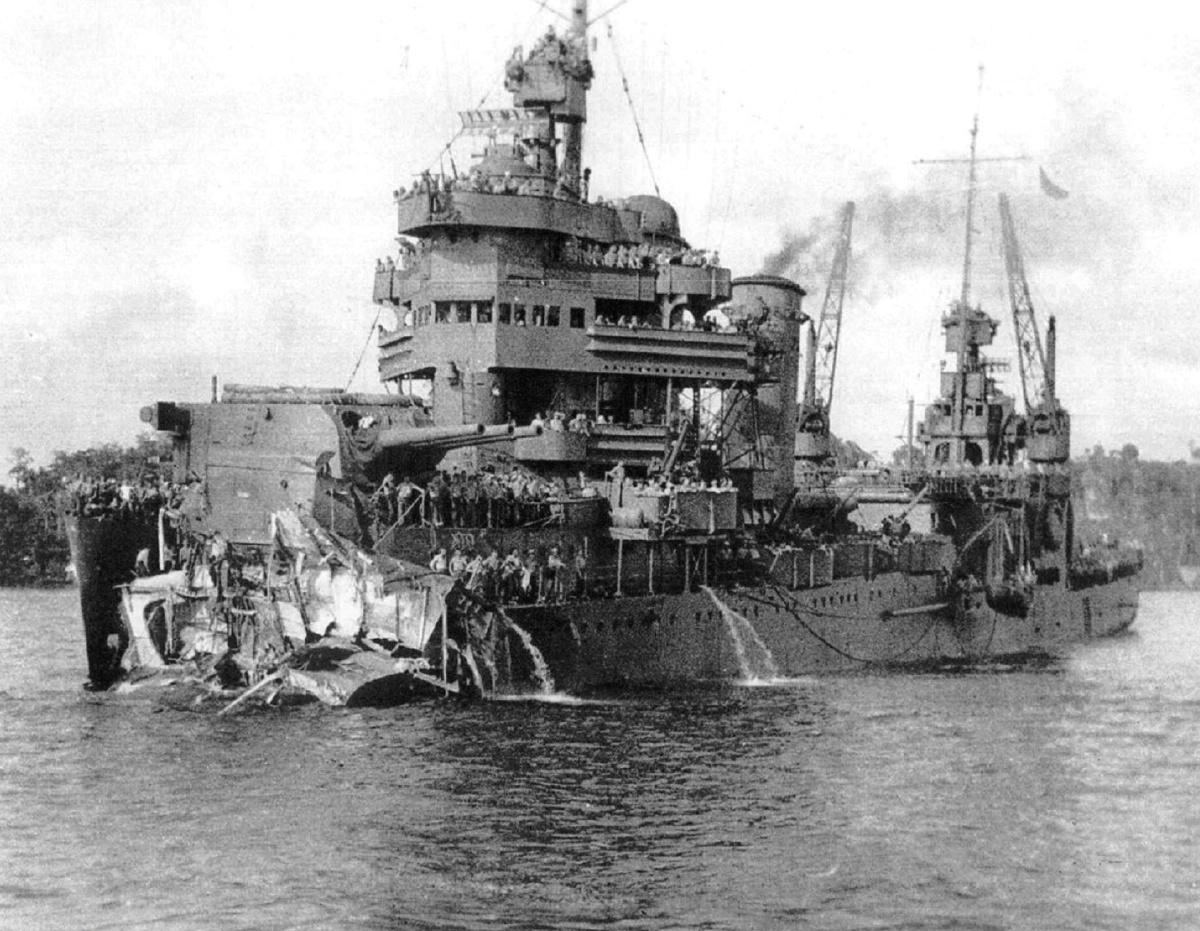
Mayer calls DriX’s discovery of the USS New Orleans’s severed bow the most thrilling find, in large part due to the ship’s incredible story. A Japanese torpedo tore off nearly one-third of the ship, including the bow, killing 180 crew members. Remaining crew saved the ship (pictured above at left) by sailing it backward from Guadalcanal to Australia and then to the United States.
Watching livestreamed, high-resolution imagery of these sunken vessels, a team of onboard and remote military historians reconstructed narratives about the methods of destruction. For example, history books tell us the Teruzuki sank when depth charges exploded and it lost its stern; ROV images located the stern 250 meters away from the ship, but its depth charges were all there, unexploded.
“For me, one of the most exciting things was to recognize that in real time, we were rewriting history,” Mayer says.